Using the Wrong Tool for the Job: Why IBHS Sub-Severe Hail Research Shouldn’t Guide Forensic Damage Assessments
By Steve Smith, PE, Director of Research and Testing, Principal Forensic Engineer
Admit it. We’ve all done it. We’ve used a boot as a hammer, or a key in place of a screwdriver. We needed a tool and we opted for the nearest object that can get the job done. Not using the right tool for the job caused us to gouge the heel of our boot or bend our house key. We should have spent 60 seconds walking to the toolbox and chosen the right tool, and instead, we’ve made a mess of things. A similar thing has happened over the past couple of years, but this time, some in the roofing industry are using research papers intended to explore potential shortfalls in underwriting and risk assessment, as though the papers are forensic studies in roof damage evaluations…Using the wrong tool for the job.
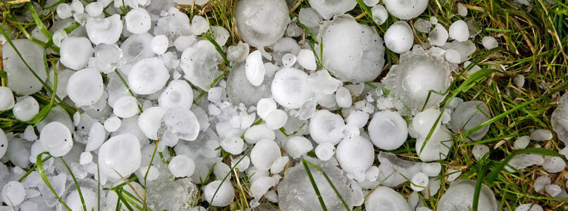
The Insurance Institute for Business & Home Safety (IBHS) released two papers that studied the effects of sub-severe hail on asphalt shingle roofing. Their papers were based on laboratory testing they conducted which included a combination of ice ball impact testing to simulate sub-severe hail and exposure to natural weathering. While the results showed that weathered shingles have less granule adhesion than new shingles, experts at Haag, a Salas O’Brien company, noted these studies were being misapplied by some individuals as evidence to justify roof replacements in the absence of hail-caused ruptures to the shingles.
Haag Experts Weigh In: Effects of Sub Severe Hail on Asphalt Shingles
Haag has authored a forensic engineering position paper—Effects of Sub-Severe Hail on Asphalt Shingles—clarifying the evidentiary boundaries between material susceptibility, normal aging, and hail-caused damage of asphalt composition shingles. The paper evaluates the recent research by IBHS regarding sub‑severe hail exposure and examines how these conclusions relate to physical damage indicators, performance impairment, and roof repair/replacement decisions following a hailstorm.
Understanding Normal Weathering vs. Hail-Caused Damage
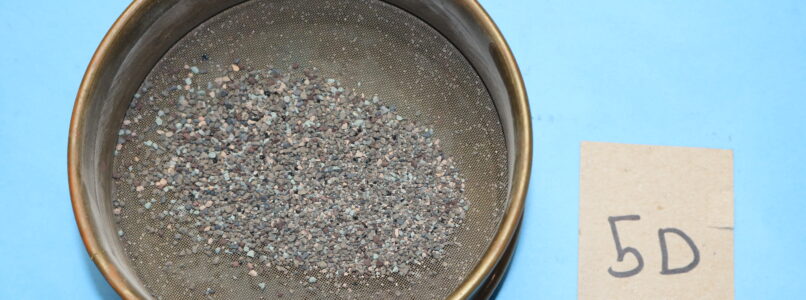
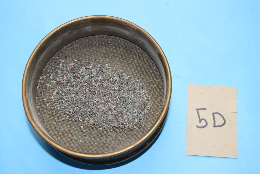
All roofs are exposed to ultraviolet (UV) radiation, thermal cycling, oxidation, and precipitation. These processes are collectively known as “long-term weathering effects” and are the primary mechanisms that degrade roofing quality over the life of a roof. Roof degradation differs by roofing type. Degradation of asphalt composition shingle roofs typically starts with granule shedding, and over the course of many years, the asphalt can crack, erode, and become brittle. Loss of granule surfacing from asphalt shingles is a normal process that happens with all asphalt shingle roofs, and occurs during packaging, transport, unpackaging, installation, and throughout the life of the shingle. Shingles with extensive, progressive granule loss can still reliably shed water for many years, and the reduction of granule surfacing does not necessarily mean an asphalt shingle roof has failed.
IBHS Research – Contributions and Limitations
The recent research by IBHS contributes meaningfully to the discussion of hail risk by demonstrating that small hailstones dominate hail climatology by frequency. Additionally, their studies can prove value in advancing risk modeling and underwriting strategies. Their research is, however, not conclusive when applied to post‑storm damage assessment, which requires a higher evidentiary standard. As previously noted, testing by IBHS included simulated hail testing and natural weathering; however, their testing was not structured to separate the contributions of each, and instead, conclusions were made regarding the combined effects of hail and weathering, which effectively allowed their research to be misused as forensic analysis…The wrong tool for the job.
View or download Effects of Sub-Severe Hail on Asphalt Shingles: A Forensic Engineering Position Paper Clarifying Evidentiary Boundaries Between Material Susceptibility, Normal Aging, and Hail‑Caused Damage, by Steve R. Smith, PE; Ronny Lindsay, PE, StS, CGC; and Christopher (Alex) DeGroot, PE.
Haag Research & Testing: Accredited Expertise
Haag Research & Testing operates an accredited testing laboratory through the International Accreditation Service (IAS) and is listed as Testing Laboratory 656 (TL-656) on the IAS website. Our forensic engineers, consultants, and technicians are experts in forensic roof evaluations, providing reliable, scientifically supported data that stands up in both claims and litigation settings.
Whether you need laboratory testing, forensic meteorology, cause and origin expert services, or scope and cost to repair expertise, Haag has the resources and expertise to support your goal.
Contact Haag to explore testing options online or 214-614-6500.

Steven R. Smith is a Forensic Engineer and Director of Research & Testing for Haag. Mr. Smith is an experienced forensic engineer who began his career with Haag in 1998. He spent seven years working as Haag’s Senior Lab Technician while earning a Bachelor of Science in Mechanical Engineering degree from The University of Texas at Arlington. He has been involved with the lab throughout his career and has been able to leverage his extensive and practical engineering field experience with research and testing projects. Mr. Smith has authored or co-authored several Haag publications, including Repairing an Existing 36-Inch Laminated Asphalt Shingle Roof with Metric-Sized Laminated Asphalt Shingles, Effects of Hail-Caused Dents on the Thermal Performance of Insulation Under Single-Ply Roofing, Testing of Impact-Resistant Asphalt Shingles, and Hail Effects on Air-Conditioner Performance. He also contributed to other publications as a laboratory technician, including Hail Damage Threshold Sizes for Common Roofing Materials, Hail Damage to Tile Roofing, and Hail Impact Resistance of Asphalt Shingle Overlays.
Mr. Smith’s areas of expertise include roofing system evaluations, components and cladding, code and standard compliance, and mechanical equipment evaluations. He is a licensed Professional Engineer in Texas, Arkansas, Oklahoma, Missouri, Minnesota, and Wisconsin. He is a member of the American Society of Mechanical Engineers (ASME) and Pi Tau Sigma National Honor Society. Prior to joining Haag, he trained at the Navy Nuclear Power Training Command Center in Orlando, Florida and was stationed aboard the USS Arkansas (CGN-41), where he maintained reactor and steam plant chemistry, performed radiological controls, and operated mechanical equipment in the propulsion plant.
Any opinions expressed herein are those of the author(s) and do not necessarily reflect those of Haag, a Salas O’Brien Company or subsidiaries.


