Month: October 2023

A Dynamic Shift in Severe Weather Warnings, November 2023

By Patrick Hyland, CCM, Senior Forensic Meteorologist

Storms move, shouldn’t the warnings move with them?

With 122 local National Weather Service (NWS) Forecast Offices covering the United States and its territories, NWS forecasters are responsible for protecting life and property through the constant surveillance of the atmosphere and issuing life-saving weather warnings when severe weather strikes.

When a weather warning is generated, a polygon is issued by the local NWS across the area for which the meteorologist believes the storm has the highest probability of producing severe weather. The creation of these warnings is typically based on observations from remote sensing systems like Doppler weather radar and other surface-based weather instrumentation, as well as public reports of severe weather via social media, email, or telephone.

Once the warning is issued, the storm moves through the warning polygon with time. As the storm nears the end of the polygon, the NWS forecaster must decide whether to issue a new polygon to continue warning subsequent locations ahead of the storm of a continuing threat for severe weather or cancel/allow the warning to expire due to a decreasing threat of severe weather. This piecemeal process for warning generation creates inequitable lead times for severe weather along the path of the storm – in particular for nearly adjacent locations that may fall within or just outside the warning polygon.

The red-target indicator illustrates a hypothetical storm (moving left to right), while the yellow polygons represent severe weather warnings (muted yellow polygon is the previous warning and the bright yellow polygon is the new warning). Note that locations A and B are nearly adjacent, yet the lead time for location A is greater than location B.

A proposed new method for warning generation is in the research and development phase that would transform static severe weather warnings to dynamic, continuously updating warnings that follow the storm. This concept, called Threats-in-Motion (TIM), is the first step in a larger initiative known as Forecasting a Continuum of Environmental Threats (FACETs) that aims to improve the forecast and warning process across all environmental hazards through the communication of probabilistic hazard information (PHI). Through several iterations of experiments with NWS forecasters utilizing archived and real-time weather scenarios, these moving warnings have been shown to create more equitable lead times and allow for improved communication as storms move downstream.

The TIM concept is expected to be introduced operationally to the NWS in phases. The first implementation that is closest to operational readiness is Tiny TIM, which will allow forecasters to extend the area and time of severe weather warnings while maintaining the same Event Tracking Number (ETN). In this regard, the forecaster can keep the same warning with the storm throughout its lifecycle – “one storm, one story” – which is especially useful with long-track, long-lived storms. Not only does Tiny TIM help reduce forecaster workload since the overall number of warnings decreases, but it will also help to eliminate overlapping warnings that can lead to communication issues in complex weather events. The capabilities of Tiny TIM will be extended with the future introduction of Taller TIM in which the warning will move continuously downstream at one-minute increments upon issuance until the forecaster intervenes to update the warning. Taller TIM creates even more equitable lead times for severe weather than Tiny TIM as well as improved departure, or “All Clear”, messaging. The final phase in this new warning paradigm will include PHI alongside these warning objects to communicate storm evolution, intensity, duration, and trend information. PHI has the potential to provide user-specific products that can be adapted to fit the needs of any individual or organization.

From Stumpf and Gerard (2021). Image shows the one-minute lead times along a hypothetical tornado path for current NWS warnings (blue), Tiny TIM (gray), and Taller TIM (orange). Note how lead time equitability improves with Tiny TIM compared to current NWS warnings, with even further improvement when utilizing Taller TIM.

One of the most critical elements required in the implementation of this new warning paradigm is dissemination. Through these experiments and testing, researchers are also engaging with emergency managers, broadcast meteorologists, and individuals throughout the weather enterprise from operations to the private sector to understand how to effectively relay moving, continuously updating warnings to the public. TIM represents a dramatic change in the way warning information is communicated, so it is vital to make sure that the infrastructure and partners are well prepared for the future of severe weather warnings in the United States.

Haag’s team of meteorologists have been involved in extensive field projects and research spanning the weather, water, and climate enterprise and continue to stay on top of advancements in the field. Our forensic meteorological services continue to expand and evolve with changes in our understanding of weather information. Contact one of our meteorologists today for your forensic meteorology needs.

For more information on the TIM concept, please refer to the included publication and website links:

Author

Patrick Hyland, CCM, Senior Forensic Meteorologist

Patrick Hyland, CCM, is a Forensic Meteorologist with Haag Engineering. Mr. Hyland has over 15 years of experience in meteorology, including ten years providing meteorological consulting services for a variety of cases where expertise is required. He most recently served as a Research Meteorologist with the NOAA National Severe Storms Laboratory (NSSL) Warning Research Development Division (WRDD). He was responsible for developing cutting-edge tools, algorithms, products, and techniques to improve the warning-decision-making process for use in operational National Weather Service (NWS) Forecast Offices for the protection of life and property. He focused on radar severe weather applications, probability and impacts research, and the Multi-Radar Multi-Sensor (MRMS) system.


Any opinions expressed herein are those of the author(s) and do not necessarily reflect those of Haag Technical Services, Haag Engineering Co., Haag Education, or parent company, Haag Global, Inc.

Turbocharger Oil Delivery Pipe May Leak: Ferrari North America, Inc. is recalling certain 2022-2024 SF90 Stradale and SF90 Spider hybrid electric vehicles.

NHTSA Campaign Number: 23V698000

Manufacturer Ferrari North America, Inc.

Components ENGINE AND ENGINE COOLING

Potential Number of Units Affected 614

Summary

Ferrari North America, Inc. (Ferrari) is recalling certain 2022-2024 SF90 Stradale and SF90 Spider hybrid electric vehicles. The turbocharger oil delivery pipe may have been manufactured incorrectly, which can lead to an oil leak.

Remedy

Owners are advised not to drive their vehicles until the remedy has been completed. Dealers will replace the turbocharger oil delivery pipes, free of charge. Owner notification letters are expected to be mailed December 16, 2023. Owners may contact Ferrari customer service at 1-201-816-2668. Ferrari’s number for this recall is RC 86.

Notes

Owners may also contact the National Highway Traffic Safety Administration Vehicle Safety Hotline at 1-888-327-4236 (TTY 1-800-424-9153), or go to www.nhtsa.gov.

Cables May Contact Brackets Causing Short Circuit: Winnebago Industries, Inc. is recalling certain 2020-2024 Revel motorhomes.

NHTSA Campaign Number: 23V663000

Manufacturer Winnebago Industries, Inc.

Components ELECTRICAL SYSTEM

Potential Number of Units Affected 4,968

Summary

Winnebago Industries, Inc. (Winnebago) is recalling certain 2020-2024 Revel motorhomes. The cables near the lithium batteries may contact the battery hold-down brackets, which can damage the cables and cause a short circuit.

Remedy

The remedy is currently under development. Owner notification letters are expected to be mailed November 28, 2023. Owners may contact Winnebago customer service at 1-641-585-6939 or 1-800-537-1885. Winnebago’s number for this recall is 178.

Notes

Owners may also contact the National Highway Traffic Safety Administration Vehicle Safety Hotline at 1-888-327-4236 (TTY 1-800-424-9153), or go to www.nhtsa.gov.

Improperly Secured Electrical Wiring Harness: Mercedes-Benz USA, LLC (MBUSA) is recalling certain 2022-2023 AMG SL55 and AMG SL63 vehicles.

NHTSA Campaign Number: 23V676000

Manufacturer Mercedes-Benz USA, LLC

Components ELECTRICAL SYSTEM

Potential Number of Units Affected 5,326

Summary

Mercedes-Benz USA, LLC (MBUSA) is recalling certain 2022-2023 AMG SL55 and AMG SL63 vehicles. The electrical wiring harness for the starter and alternator may not be secured properly, which can result in a short circuit and a loss of drive power or cause the harness to overheat.

Remedy

Dealers will secure the electrical wiring harness for the starter and alternator, free of charge. Owner notification letters are expected to be mailed December 5, 2023. Owners may contact MBUSA customer service at 1-800-367-6372.

Notes

Owners may also contact the National Highway Traffic Safety Administration Vehicle Safety Hotline at 1-888-327-4236 (TTY 1-800-424-9153), or go to www.nhtsa.gov.

Incorrect Fuse May Cause Fire: Forest River, Inc. is recalling certain 2024 Coachmen Brookstone, Chaparral, Chaparral Lite, and Shasta Phoenix fifth wheel trailers.

NHTSA Campaign Number: 23V660000

Manufacturer Forest River, Inc.

Components ELECTRICAL SYSTEM

Potential Number of Units Affected 50

Summary

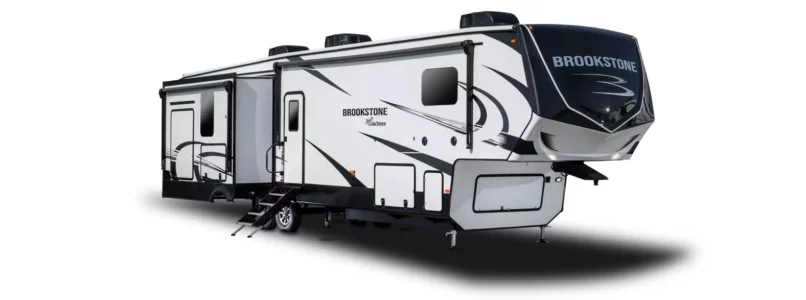
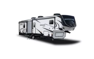
Forest River, Inc. (Forest River) is recalling certain 2024 Coachmen Brookstone, Chaparral, Chaparral Lite, and Shasta Phoenix fifth wheel trailers. The affected vehicles may have been manufactured with an incorrect fuse in the power distribution center.

Remedy

Dealers will replace the fuse with a 15-AMP 12-Volt fuse, free of charge. The manufacturer has not yet provided a notification schedule. Owners may contact Forest River Customer Service at 1-574-825-7101. Forest River’s number for this recall is 110-1686.

Notes

Owners may also contact the National Highway Traffic Safety Administration Vehicle Safety Hotline at 1-888-327-4236 (TTY 1-800-424-9153), or go to www.nhtsa.gov.

Haag’s Hurricane GeoPortal- Interactive Storm Data, Oct. 2023

Haag’s HURRICANE GEOPORTAL: timely access to reliable data

In August, NOAA’s Climate Prediction Center (a division of the National Weather Service), updated their 2023 hurricane outlook. “Due to current ocean and atmospheric conditions, such as record-warm sea surface temperatures, NOAA’s Climate Prediction Center has increased their prediction for the ongoing 2023 Atlantic hurricane season to an “above normal” level of activity from a “near normal” level with their most recent update.” NOAA now predicts “a 70% chance of 14-21 named storms, of which 6-11 could become hurricanes, and 2-5 could become major hurricanes.”1

In light of the outlook for 2023 and considering active recent hurricane seasons, it is imperative for businesses and individuals to have quick and reliable access to key data points. Haag believes that there is no such thing as too much data if the data is organized, relevant, easy to access, and easy to understand. Haag’s Hurricane Geoportal gives users the power to view multiple datasets, interact with the data, and decide which information is most valuable to them. The Haag Hurricane Geoportal utilizes a map-based interface to provide on-demand access to several useful data sources including:

  • Real-time data for active and recent storms from the current hurricane season
  • Detailed storm data from the past three hurricane seasons with options to filter data based on storm name
  • Wind speeds and pressure at observed positions along a storm’s path
  • Direct access to official National Hurricane Center (NHC) storm reports
  • Radar and aerial imagery data for storms
  • Access to local climatological data reports
  • NEXRAD radar mosaics for current and past storms
Satellite imagery, observed track and positions, forecasted track and positions of Hurricane Ida, August 2021.
Before and after aerial imagery showing damages caused by Hurricane Laura, August 2020.

The Haag Hurricane Geoportal provides timely access to reliable data in one easy-to-use platform. While we can’t stop severe weather from happening, we can create tools to help make proactive planning and recovery much easier. The Hurricane Geoportal is your one-stop shop for keeping an eye on the data for the eye of the storm.

If you would like to learn more about the Haag Hurricane Geoportal, please contact Marcie Deffenbaugh, GIS Services Manager, to view a demo or for more information. Haag’s Hurricane Geoportal is available via subscription– one year subscription for $50/month or opt for a month-to-month subscription for $75/month.

1. Source: “NOAA Releases Updated 2023 Atlantic Hurricane Season Outlook” https://www.nesdis.noaa.gov/news/noaa-releases-updated-2023-atlantic-hurricane-season-outlook#:~:text=The%20outlook%20now%20includes%20a,the%20ongoing%20El%20Ni%C3%B1o%20event .)

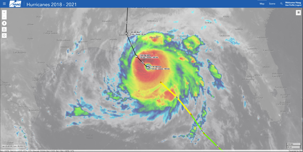
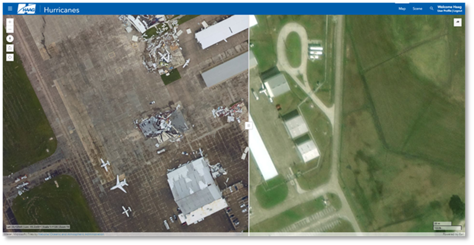
Marcie Deffenbaugh is the Manager of GIS Services for Haag Technical Services, a division of Haag Global, Inc.  In this role, Ms. Deffenbaugh oversees initiatives related to GIS planning, system design, and system administration. She also manages a staff of GIS technicians, analysts, cartographers, and project administrative assistants who provide data validation and project management services for oil and gas clients. As the primary liaison between the client management teams and Haag Technical Services personnel, Ms. Deffenbaugh provides technical consulting services on a regular basis.

___

Any opinions expressed herein are those of the author(s) and do not necessarily reflect those of Haag Technical Services, Haag Engineering Co., Haag Education, or parent company, Haag Global, Inc.

ABS Unit May Cause Engine Compartment Fire; Hyundai Motor America is recalling certain makes and models.

NHTSA Campaign Number: 23V651000

Manufacturer Hyundai Motor America

Components SERVICE BRAKES, HYDRAULIC

Potential Number of Units Affected 1,642,551

Summary

Hyundai Motor America (Hyundai) is recalling certain 2011-2015 Elantra, Genesis Coupe, Sonata Hybrid, 2012-2015 Accent, Azera, Veloster, 2013-2015 Elantra Coupe, Santa Fe, 2014-2015 Equus, 2010-2012 Veracruz, 2010-2013 Tucson, 2015 Tucson Fuel Cell, and 2013 Santa Fe Sport vehicles. The Anti-Lock Brake System (ABS) module may leak brake fluid internally and cause an electrical short, which can result in an engine compartment fire while parked or driving.

Remedy

Owners are advised to park outside and away from structures until the recall repair is complete. Dealers will replace the ABS fuse, free of charge. Owner notification letters are expected to be mailed November 21, 2023. Owners may contact Hyundai customer service at 1-855-371-9460. Hyundai’s number for this recall is 251.

Notes

Owners may also contact the National Highway Traffic Safety Administration Vehicle Safety Hotline at 1-888-327-4236 (TTY 1-800-424-9153), or go to www.nhtsa.gov.