Unlocking Business Potential Through gis:
Streamline Operations and Boost Decision-Making
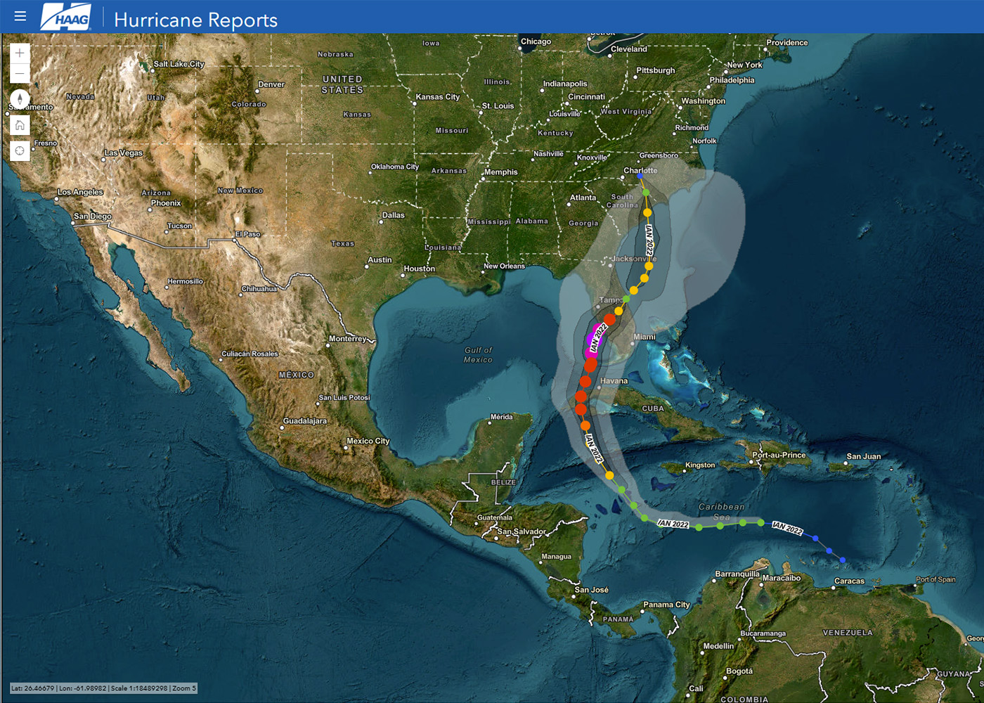
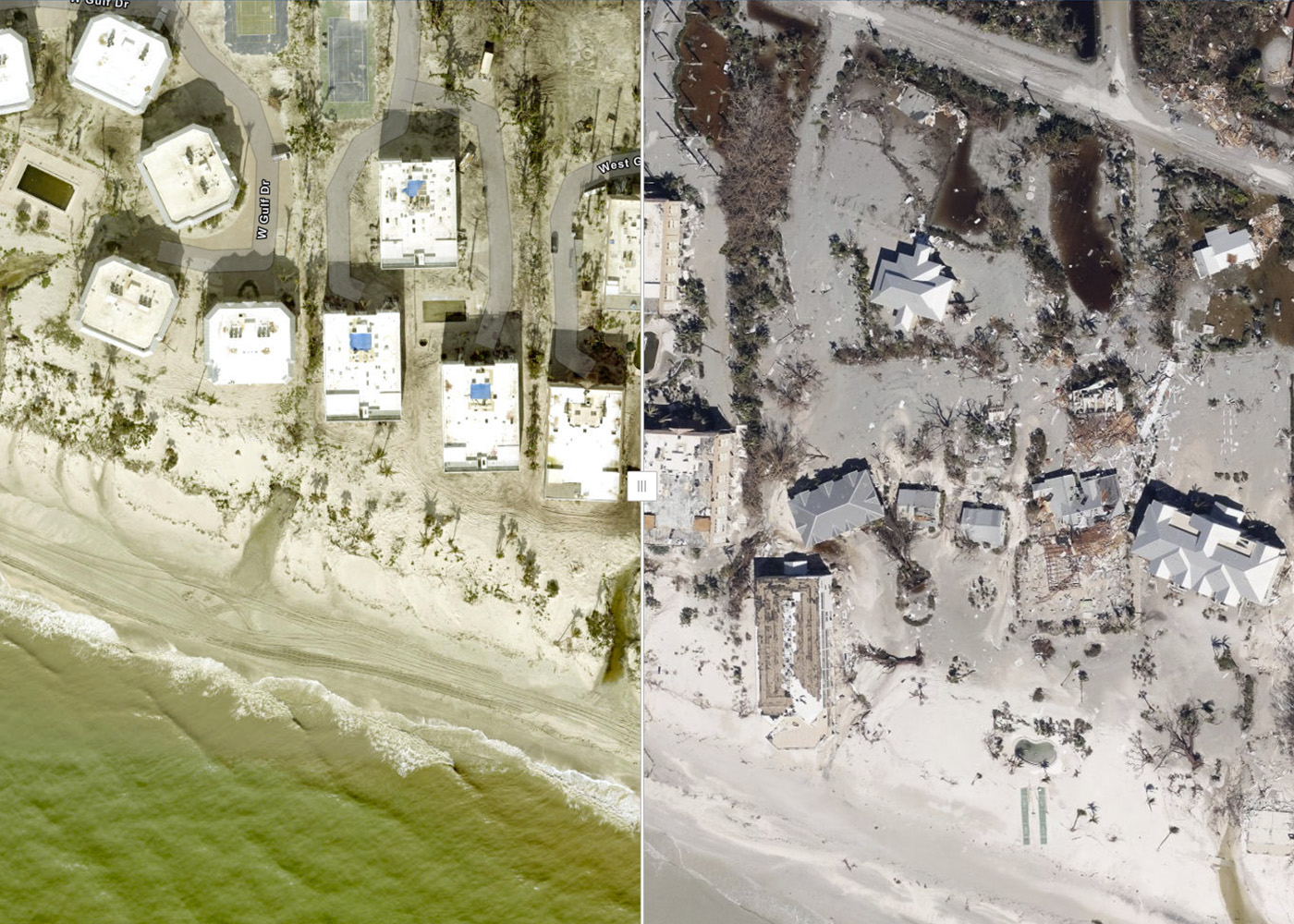
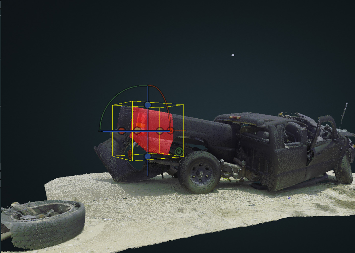
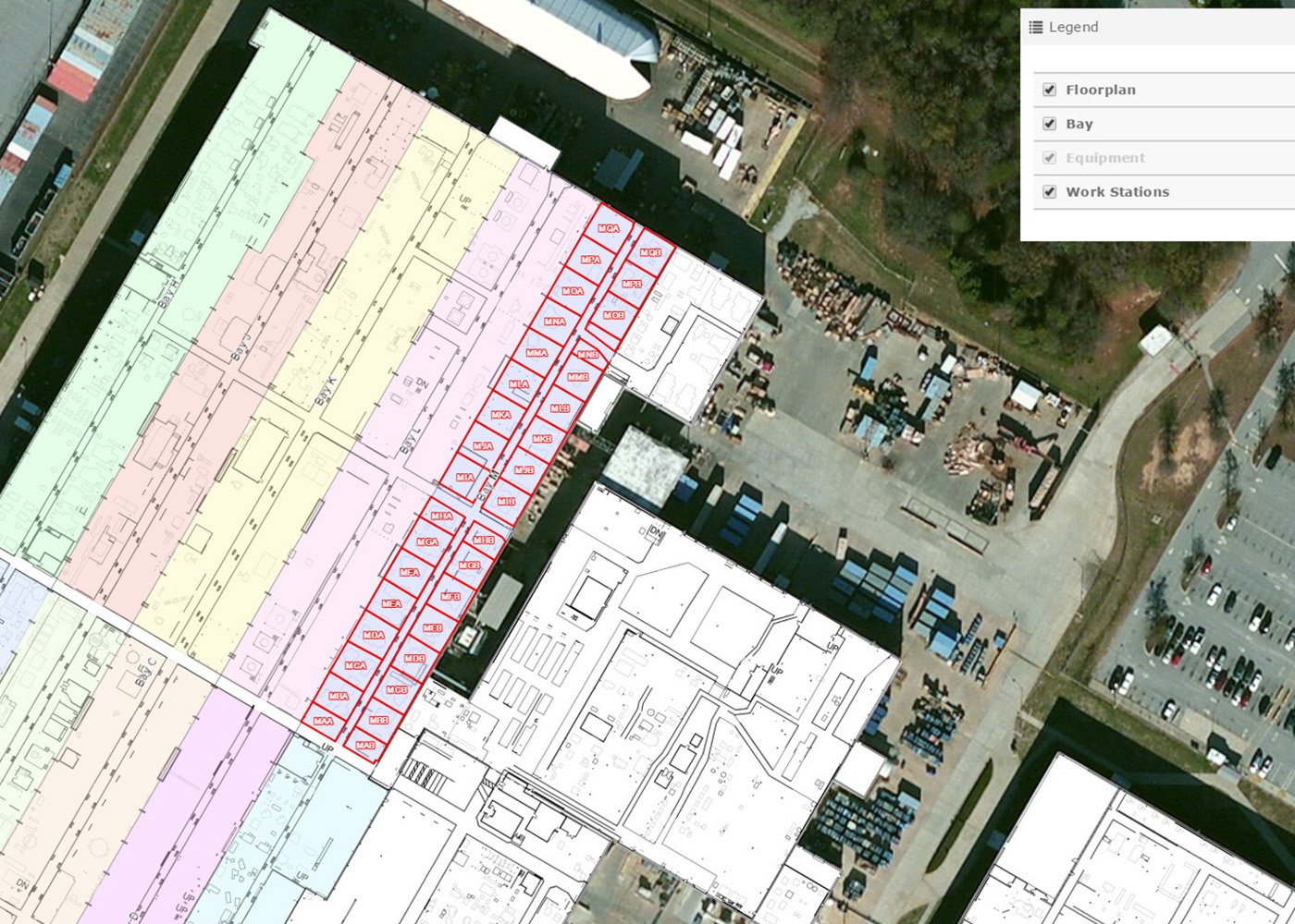
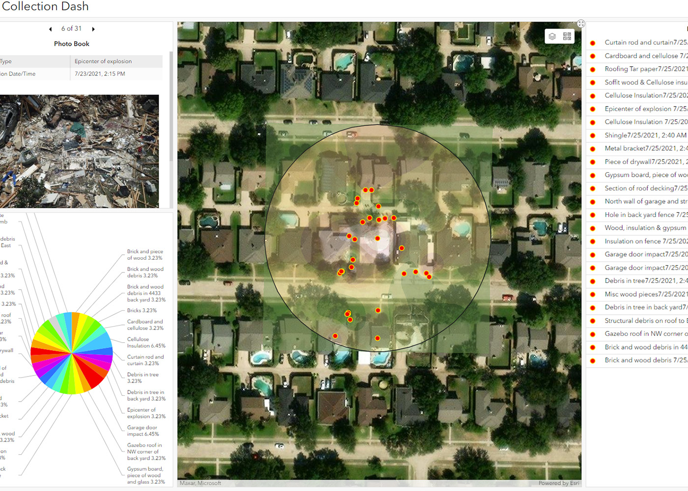
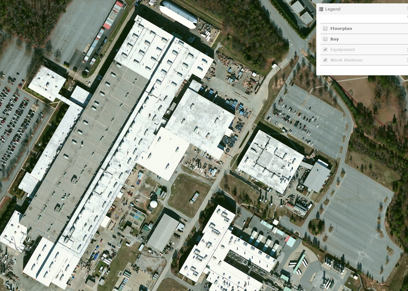
Geographic Information System (GIS) offers a powerful solution for businesses seeking to organize, integrate and visualize vast datasets. Easily overlay different datasets in various formats such as field-collected data, historical information, imagery, photography, 3D laser scans, and more onto a map for informed decision-making grounded in reliable data. GIS empowers users to deeply analyze information, identifying trends that drive process improvements. Static data is dynamically transformed, facilitating better decision-making, enhanced communication, and increased efficiency across the organization. Gain a competitive edge with GIS-driven insights, setting your business apart from the competition.
Tailored GIS Solutions for Your Business
Comprehensive GIS Services
Our GIS department offers a range of services customized to meet your business needs:
- Client Consultation & Strategy: Partner with us to strategize your GIS implementation for enhanced efficiency and decision-making aligned with your business goals.
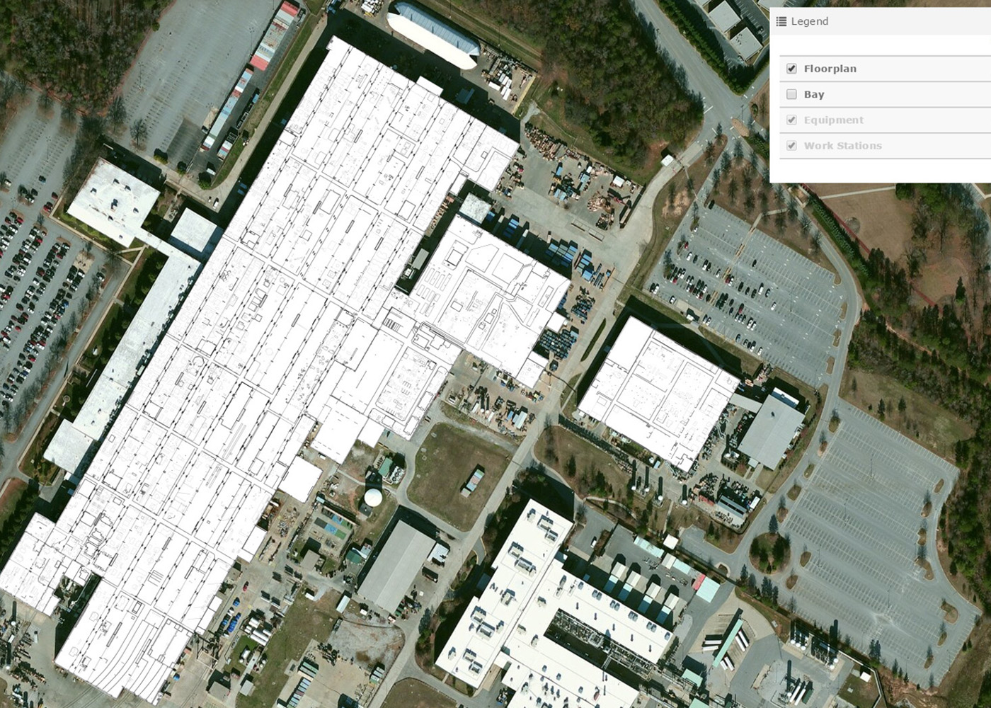
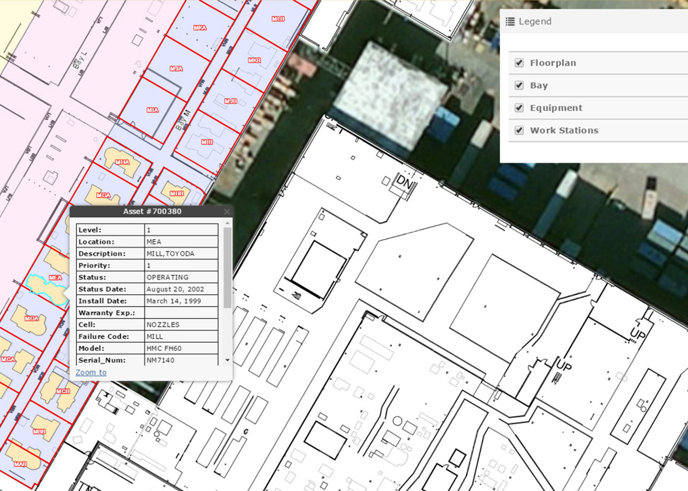
- Asset Management: Effectively manage and optimize your asset data into a centralized, cloud-based location.
- Data Collection & Workflows: Streamline data collection processes and ongoing management by integrating workflows across multiple portals and applications.
- Geospatial Architecture Design: Collaborate with our team to design strategic blueprints that guide how GIS technology and management elements work together.
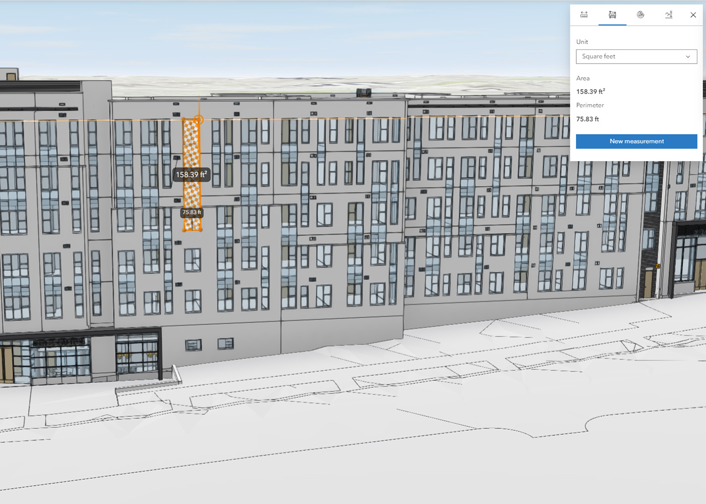
- Data Analysis and Visualization: Let our experts design custom maps and visualizations to effectively explain complex datasets to your target audience.
- Haag Geoportal Web Mapping: Access intuitive web mapping solutions for data visualization and gain valuable insights for your business.
- GIS Training: Equip your team with the skills to harness GIS technology effectively.
- Implementation & Support: Rely on our experienced team for seamless GIS implementation and support.

Request a Consultation
Our geospatial experts are passionate about helping clients achieve success through innovative ideas, cutting-edge technology, and a partnered approach. Submit your information below to discuss how GIS or other technologies can benefit your project.