Haag's Storm REPORTS Portal:
Accurate, Reliable Weather Data for Insurance and Legal Professionals
According to the National Oceanic and Atmospheric Administration (NOAA), 2023 produced an unprecedented number of billion-dollar disasters – 28 in total – across the United States. This is the highest number of billion-dollar disasters in the U.S. on record. In the first six months alone, 12 individual billion-dollar weather and climate disasters devastated parts of the nation. These 28 events from 2023 included 17 severe weather/hail events and two tornado outbreaks. According to NOAA’s billion-dollar disaster record dating back to 1980, the U.S. has sustained 376 separate weather and climate disasters exceeding a cumulative cost of $2.660 trillion.
As homes and properties are increasingly affected by severe weather, access to reliable information about these events is critical. NOAA and several other agencies meticulously track these events and have incredible amounts of data available to users. But which sites should you access? How can these events be seen in relation to your property? How do you know which events have impacted a specific location over the years? The Haag Geoportal has the answers to these questions.
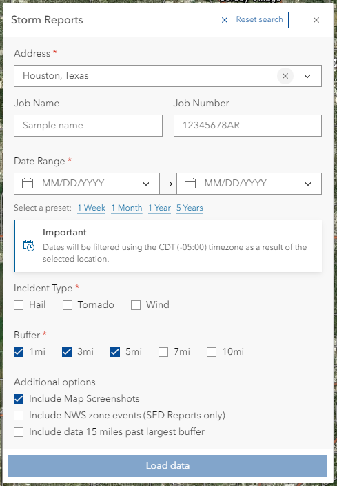
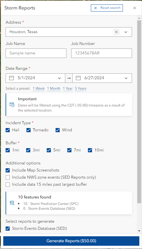
The Storm Reports portal on the Haag Geoportal is the ultimate tool for accessing detailed, reliable, and accurate weather reports for wind, hail, and tornado events. It is a powerful mapping application that aggregates data from multiple sources and displays results in an easy-to-understand visual and interactive format. Users search for a location, enter a date range, and select events they are interested in from hail, wind, and tornado options. The Storm Reports portal compiles data from the Storm Prediction Center (SPC; preliminary data that is updated daily) and the Storm Events Database (SED; finalized data available approximately 90 days after an event occurred) and displays relevant events based on the search criteria. Users then have the option to export a PDF report with details about each event including date and time of occurrence, location, magnitude, distance from the location, event narrative, and more. Data is derived from verified national weather sources and is never manipulated, which makes it perfect for insurance professionals, forensic investigators, legal professionals, etc.
Initial location search:
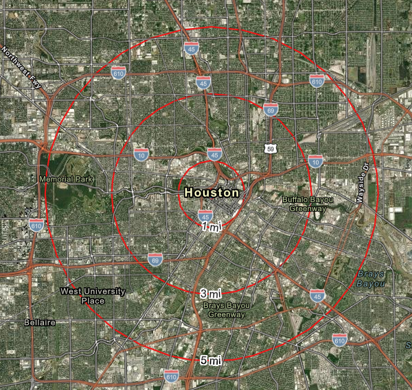
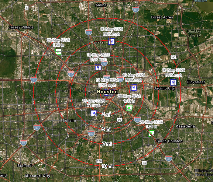
Haag’s Storm Portal reports cover a robust 14-year span (2010 to present day) of weather events and are updated daily, ensuring you have the most accurate and historical data available. These reports are an invaluable tool when trying to assess where events occurred and the magnitude of the events. The data also provides insights into weather patterns – clusters of events show where storms passed through an area and which locations could have been impacted the most severely. When paired with an on-site inspection by a Certified Consulting Meteorologist (CCM), the comprehensive data provided in the reports is invaluable for professionals who need to document and verify weather events. Whether you’re assessing property damage, preparing legal cases, or conducting forensic analysis, the Haag Geoportal provides the accurate and reliable data you need.
As global temperatures rise, the number of severe events will continue to increase. Users of all types need a way to research and understand the impact of weather, especially when it affects their property. The Haag Geoportal allows users to unlock precise weather history and view reliable, verified data to streamline the weather analysis process. Sign up today and experience the difference that weather reporting can make. For more information and to sign up for a free account, visit the Haag Geoportal site today or contact our Geoportal team at geoportal@haagglobal.com.
We’re excited to announce that our Hurricane Report will be available soon for the 2024 hurricane season. This report will feature detailed storm data, Local Storm Reports (LSRs), high water mark data, peak summaries, and more. Stay tuned for this addition to the Haag Geoportal.
Data display after clicking load data with desired specifications:
About the Author
Marcie Deffenbaugh, Manager, GIS Services

Marcie Deffenbaugh is the Manager of GIS Services for Haag, a Salas O’Brien Company. Ms. Deffenbaugh oversees initiatives related to GIS planning, system design, and system administration. She also manages a staff of GIS technicians, analysts, cartographers, and project administrative assistants who provide data validation and project management services for oil and gas clients. As the primary liaison between the client management teams and Haag personnel, Ms. Deffenbaugh provides technical consulting services on a regular basis.
Any opinions expressed herein are those of the author(s) and do not necessarily reflect those of Haag, a Salas O’Brien Company or subsidiaries.

